


Estimated reading time: 9 minutes
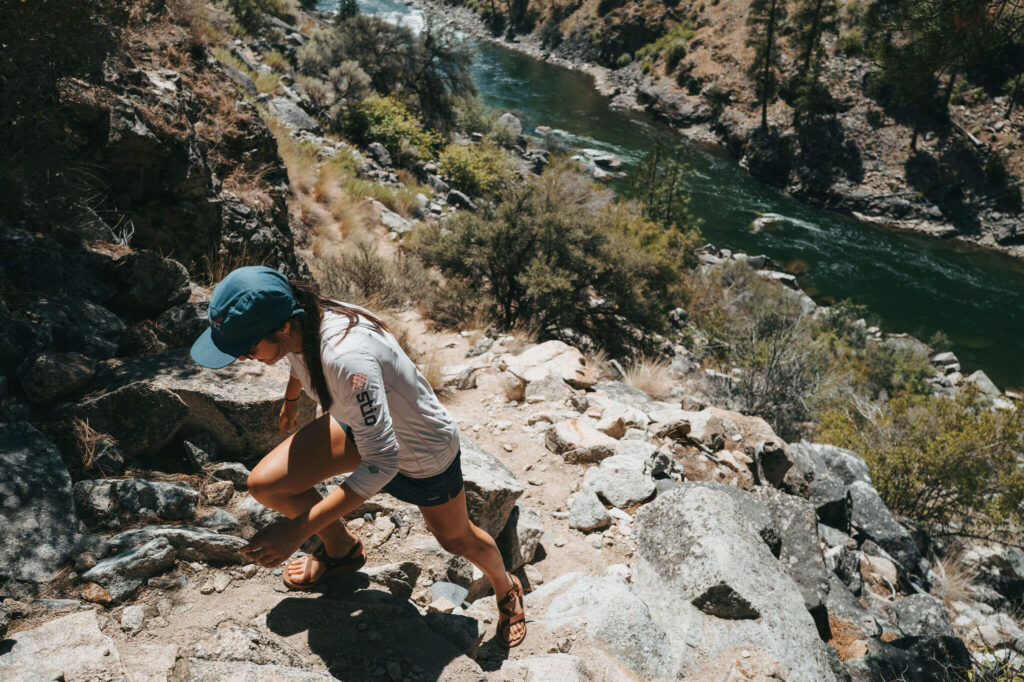
A Middle Fork rafting trip is also a journey through a living cultural landscape. Optional walks can lead to painted pictographs, weathered cabin sites, waterfalls, and short sections of the Middle Fork Trail. The exact stops change from trip to trip, but the best way to prepare does not: bring secure footwear, follow your guide, and approach cultural places as sites to learn from and protect.
This guide explains what those side trips may involve, what determines whether a stop is possible, and how to visit sensitive places respectfully. For feature locations and river miles, use our Middle Fork mile-by-mile guide.
Middle Fork Side Hikes at a Glance
| Possible experience | What to expect and plan for |
|---|---|
| Pictograph or archaeological site | Painted images, rock shelters, house-pit depressions, or other evidence of long human use; quiet observation, no touching, and strict leave-in-place practices |
| Historic cabin or homestead site | Log walls, foundations, ditches, meadows, or stories about mining and ranching; uneven ground and fragile structures that may not be safe to enter |
| Waterfall or canyon walk | Veil Falls, Waterfall Creek, or another short trail from the river; rock, sand, short steep sections, and conditions that change by season |
| Middle Fork Trail segment | A walk that parallels the river between a launch, lunch, or camp stop; a longer optional outing coordinated with the boats and the day’s schedule |
These are possibilities, not a promised itinerary. Campsite assignments, river flow, weather, daylight, trail condition, closures, group energy, and cultural-resource guidance can all change the day’s plan.
A Cultural Landscape, Not an Outdoor Museum
The Middle Fork flows through the Frank Church–River of No Return Wilderness and was among the first eight rivers protected when the Wild and Scenic Rivers Act became law in 1968. Its protected values include more than scenery and recreation: the corridor holds evidence of Indigenous life extending back thousands of years, as well as later mining, homesteading, ranching, and Forest Service history.
The Forest Service’s Middle Fork heritage guidance identifies descendants of the canyon’s Indigenous inhabitants among present-day Shoshone-Bannock, Shoshone-Paiute, and Nez Perce communities. It also emphasizes that pictographs, house pits, rock shelters, and related places may be sacred and should be approached with great care.
That context matters. A painted panel is not merely a photo backdrop, and a circular depression is not simply an odd feature in the ground. Some meanings and locations are appropriately kept within descendant communities or protected by land managers. A respectful visit centers what your guide can responsibly share without treating a living heritage as a puzzle for visitors to solve.
Pictographs Along the Middle Fork
Pictographs are images painted onto rock; petroglyphs are carved or pecked into it. The National Park Service’s pictograph overview notes that these images can carry cultural and communicative meaning, not just aesthetic value.
Forest Service heritage materials identify pictographs as one of the principal archaeological site types found in the Middle Fork canyon. Publicly documented examples include pictographs at Rattlesnake Cave and a 1964 archival photograph of pictographs near Veil Falls. Other sensitive locations are intentionally not publicized, and this guide does not provide coordinates for them.
If your trip includes a pictograph stop, expect the experience to be interpretive rather than hands-on. Your guide may ask the group to stay on a defined route, view from a particular distance, keep voices low, or limit the number of people near a panel at one time.
How to view pictographs responsibly
- Look without touching. Skin oils can darken and damage rock imagery.
- Never wet, chalk, trace, or repaint an image. The National Park Service’s rock-image preservation guidance warns that introducing substances or adding marks can permanently alter a site.
- Keep artifacts and rocks exactly where they are. Their location and relationship to nearby features are part of the archaeological record.
- Use established paths and durable ground. Avoid walking through house-pit depressions, fragile soils, or restoration areas.
- Photograph only where permitted. Follow your guide’s direction, and avoid sharing precise coordinates for sensitive sites that land managers do not broadly identify.
Historic Cabins and Homestead Traces
The canyon’s historic structures tell a different, later chapter. A Forest Service assessment of the Middle Fork’s historic values notes that mining and homesteading intensified around 1885 and names Joe Bump, Parrott, Sader, and Power House sites as outstanding examples of the corridor’s historic resources.
What remains varies. One stop may include recognizable cabin walls; another may be a foundation, an irrigation ditch, a meadow, or scattered evidence that only makes sense with interpretation. These sites can open a useful conversation about the difficult realities of living and working in an isolated canyon—and about how the river corridor changed as Indigenous families were displaced and newcomers established mines, ranches, and homesteads.
Historic does not mean sturdy. Logs can shift, roofs can fail, and nails or glass may be hidden in the ground. Unless a guide or land manager clearly says otherwise:
- Do not enter a cabin or enclosed structure.
- Do not lean on walls, sit in doorways, or climb on roofs and foundations.
- Leave nails, tools, glass, cans, and other objects in place.
- Keep food and drinks away from structures and artifacts.
- Tell a guide if you notice fresh damage or a displaced object.
Federal law protects archaeological resources on public and Tribal lands. The Archaeological Resources Protection Act prohibits unauthorized excavation, damage, and removal. The simplest rule is also the best one: discover the story without taking part of it home.
Waterfalls, Canyons, and Trail Walks
Not every side hike is a cultural-site visit. Depending on the itinerary, a group may walk to a waterfall, explore a side canyon, or follow a short section of the trail that parallels much of the upper and middle river corridor.
Veil Falls and Waterfall Creek are among the best-known landmarks on the lower river. Their appearance changes through the season: spring runoff can make falling water more dramatic, while later-season flows may be lighter. Other outings may be simple leg-stretchers from camp or longer walks that let willing hikers travel briefly by trail while the boats continue downstream.
For a location-focused overview, see the mile-by-mile guide to Middle Fork rapids, hikes, and landmarks. For soaking destinations and water-specific etiquette, use our dedicated Middle Fork hot springs guide rather than treating every hot spring as a side-hike stop.
What Determines the Day’s Stops?
A guided river trip is dynamic. Even a favorite landmark may not fit a particular departure. Guides balance several factors before offering a side hike:
- Camps and timing. Assigned camps, lunch locations, and daily mileage determine which pullouts are practical.
- River conditions. Flow affects travel time, eddies, landings, and how easily boats can regroup.
- Trail and weather conditions. Heat, rain, smoke, loose rock, vegetation, and recent disturbance can change a short walk.
- Site protection. A closure, restoration project, or updated land-manager or Tribal guidance takes priority over a planned visit.
- The group. Guides consider mobility, interest, energy, and whether everyone can participate safely or has a comfortable alternative.
This is why MFRT describes specific hikes as possibilities rather than guarantees. Flexibility protects both guests and the places they came to see.
How to Prepare for Optional Side Hikes
You do not need backpacking gear for a short walk from the river, but rafting sandals are not ideal for every slope. Keep these items accessible in your day bag:
- Closed-toe shoes or light hiking shoes with reliable traction
- A refillable water bottle
- Sun protection, including a hat and sunscreen
- A light insulating or rain layer
- Personal medication you may need away from the boats
- A camera or phone that can be secured when both hands are needed
Use the complete Middle Fork rafting packing list for clothing and equipment decisions, and review River 101 for what MFRT provides. Before leaving the boats, ask your guide about distance, footing, exposure, and whether you can turn around early.
Choose the outing that fits you
Side hikes are optional. A guest may join every available walk, choose only a gentle trail, or stay near the boats and still have a complete river experience. Parents should make the same decision based on the specific child’s balance, listening skills, energy, and comfort on uneven ground—not age alone.
When a route is steeper or more exposed, the useful question is not “Can most people do it?” Ask, “What will the footing and pace be today, and what is the turnaround plan?” Your trip leader has the current answer.
A Five-Step Site-Visit Checklist
Before any cultural or historic stop, remember:
- Pause and listen. Let the guide explain the route, boundaries, and significance of the place.
- Stay on the agreed path. Durable routes help protect features that may be difficult to recognize.
- Observe without altering. Do not touch imagery, move artifacts, build rock stacks, or enter unstable structures.
- Photograph thoughtfully. Respect any restrictions and keep sensitive location details private.
- Leave together. Check that your group has carried out every personal item and created no new trace.
The goal is not merely to leave a site looking undisturbed. It is to leave its physical context, cultural dignity, and future meaning intact.
Middle Fork Side Hikes and Historic Sites FAQ
Guides look for worthwhile opportunities on every trip, but no specific side hike or historic stop is guaranteed. Campsite assignments, water, weather, timing, closures, and group needs determine what is possible.
Not necessarily. Pictograph visits depend on the itinerary and current site guidance. When a visit is appropriate, expect your guide to set clear boundaries for viewing and photography.
They vary from short walks to steep, rocky climbs. Ask about distance, footing, exposure, and turnaround options before leaving the boats; every outing is optional.
Many children can enjoy selected walks, but readiness depends on the individual child and that day’s route. Guides and parents should consider balance, stamina, listening skills, heat, exposure, and the option to turn back.
Leave it exactly where it is and point it out to your guide. Moving an object can erase archaeological context, and unauthorized removal or damage on federal land may violate the law.
Bring closed-toe shoes or light hikers with good traction in addition to your river footwear. Keep them accessible rather than packed deep in your overnight dry bag.
Add More Than Whitewater to Your Middle Fork Trip
Pictographs, cabin sites, waterfalls, and quiet trail miles add depth to a Middle Fork journey—but the itinerary works best when it stays flexible. MFRT’s guides connect each possible stop with the river conditions, group, and stewardship guidance they encounter that day.
If you want a trip with room for whitewater, history, and optional exploration, contact Middle Fork Rapid Transit to talk through your group’s interests and mobility needs.