

Estimated reading time: 6 minutes
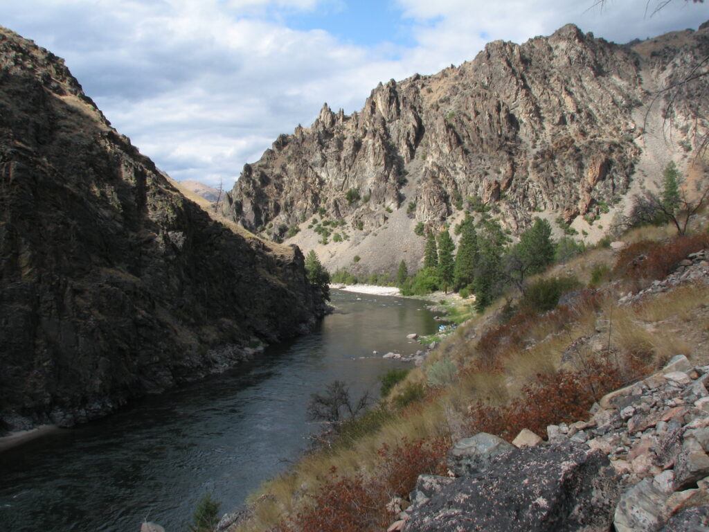
Middle Fork weather changes by month, elevation, canyon position, and year. The useful planning question is not “What exact temperature will we get?” It is “What range of conditions should my clothing system handle?”
This guide separates three kinds of evidence:
- observed climate normals near Stanley, useful for the upper-river travel window;
- current forecasts and river gauges, useful shortly before departure;
- MFRT operating experience, useful for how those conditions feel during a moving wilderness trip.
It does not treat a downstream Main Salmon gauge as a precise Middle Fork water thermometer.
Why One Forecast Cannot Describe the Whole Trip
The route loses substantial elevation between the upper river and Cache Bar. Camps differ in shade, exposure, and canyon airflow. A warm lower-canyon afternoon can follow a cold upper-river morning, and a thunderstorm can change the experience quickly.
Use a Stanley forecast as one planning input, not a corridor-wide promise. Bring insulation and rain protection even when the forecast looks stable.
For river volume and rapid character, use the separate Middle Fork CFS by month guide. Flow and temperature are related to snowmelt and weather, but they are not interchangeable.
Seasonal Planning Table
| Period | Typical planning pattern | Clothing implication |
|---|---|---|
| Early to mid-June | Cold snowmelt, variable mountain weather, splashier boating | Full rain system, warm synthetic or wool layers, trip-specific cold-water gear |
| Late June | Transition toward summer with cold water still present | Keep June layers; add stronger sun protection |
| July | Generally warmer days with cool mornings and possible storms | Sun shirt plus accessible insulation and rainwear |
| August | Warm afternoons, lower flows, cooler nights later in the month | Light daytime system and reliable camp warmth |
| September | Shorter days, crisp mornings and nights, fall variability | Warmer camp and sleep layers; gloves or hat if advised |
These are planning patterns, not forecast ranges. Always follow current MFRT instructions for the exact departure.
June
June combines snowmelt-fed water with springlike mountain weather. Guests should expect cold immersion risk even on a sunny afternoon. Early-June air can shift from warm sun to rain, wind, or a cold morning.
Pack:
- waterproof rain jacket and pants;
- warm synthetic or wool base layers;
- fleece or compact insulation;
- warm hat and dry camp socks;
- the cold-water clothing MFRT specifies for the departure.
Do not assume every June trip uses the same wetsuit or drywear plan. Confirm the current equipment guidance directly. The June high-water article explains who that experience best fits.
July
July commonly delivers the classic summer contrast: strong sun during the day, cold river water, and cooler mornings or nights in the upper corridor. Afternoon storms remain possible.
The common packing mistake is replacing layers with extra warm-weather outfits. Keep one dependable wet-weather system and one dry insulation system. Protect skin and eyes from reflected sun.
For choosing July rather than another month, use the best-time guide. This page owns temperature and layering context, not the complete date-selection decision.
August
August often has warm afternoons and lower water. Later in the month, nights lengthen and mornings can feel distinctly cooler. Smoke or wildfire-related travel impacts can also change conditions even when the river corridor itself remains open.
Keep rainwear, a warm camp layer, and a warm sleep layer. Check official forecasts and fire or road information close to departure rather than relying on a seasonal average.
The late-season guide owns low-water boating, fishing, and fly-in logistics.
September
September can offer clear fall light, quiet camps, and strong fishing interest, but it also brings the broadest day-to-night clothing contrast. Cold mornings and nights are normal planning concerns; an early storm can make them more pronounced.
Add:
- warmer insulation;
- extra dry base layer;
- warm hat and socks;
- compact gloves if your trip materials recommend them.
Warm midday weather does not eliminate the need for cold-camp preparation.
What About Water Temperature?
There is no single public gauge that supports exact month-by-month temperatures for the full Middle Fork itinerary. Downstream stations on the Main Salmon reflect different elevation, tributaries, timing, and mixing. They can provide regional context but should not be converted into precise Middle Fork promises.
For guest planning, the durable conclusions are:
- snowmelt water is cold in early season;
- water generally warms through summer;
- local springs, tributaries, shade, elevation, and weather create variation;
- cold-water protection is a guide and departure-specific decision;
- anglers should reduce handling stress and follow current guidance during warm periods.
Use current USGS water data only after confirming the station and measurement actually answer your question.
Checking Conditions Before Departure
One week before travel:
- Review MFRT’s latest trip message and River 101.
- Check the National Weather Service forecast for Stanley.
- Review Idaho 511 for road conditions.
- Check official fire and closure notices if smoke or wildfire is active.
- Keep rainwear, insulation, and medication in the day bag.
Do not remove core layers based on a single long-range forecast.
Weather and Water Temperature FAQ
July and August generally offer the warmest summer pattern, but the canyon spans elevations and each year differs. Use the best-time guide to compare full trip tradeoffs.
They can be comfortable, but cool upper-river nights and sudden weather are realistic. Bring a warm sleep layer and camp insulation rather than packing for a fixed nighttime temperature.
There is no single public gauge that precisely represents the full itinerary. Treat downstream Main Salmon readings as regional context, not exact Middle Fork values.
No. Snowmelt-fed water can remain cold even during a hot afternoon, especially early in the season. Follow guide direction and trip-specific clothing guidance.
Build one sun system, one rain system, and one warm dry system. Then add the departure-specific items in MFRT’s current instructions and the [master packing list](https://middleforkrapidtransit.com/packing-lists-for-a-middle-fork-rafting-trip/).